


Eastern Pyrenees
Capcir - Eastern Pyrenees
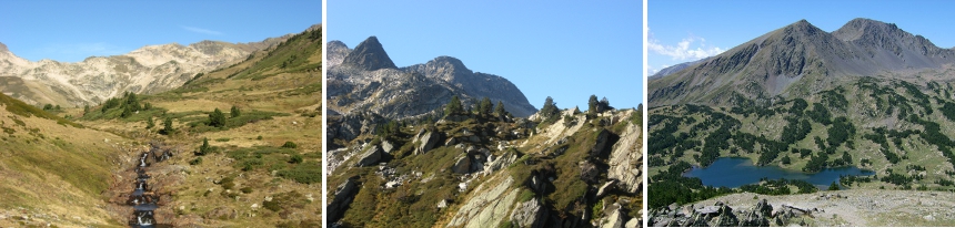
The Capcir is located in the heart of the Regional Natural Park of the Catalan Pyrenees. This plateau located between the High Valley of the Aude and Cerdanya has an altitude varying between 1400 and 1700 m, it is dominated to the east by the Madres massif (2469 m) and to the west by the Carlit massif (2921 m). It is therefore a privileged place for hiking and mountain sports. In winter, this plateau (the highest in the Pyrenean mountain range) is covered with snow and sometimes presents atmospheres worthy of "Siberia" ...
The Capcir and the surrounding peaks allow the practice of hiking, mountain biking, snowshoeing, cross-country and Nordic skiing and ski touring.


