|
|
 |






Lozere Mount Tour hiking
Hiking at the heart of the Cevennes National Park
5 days / 4 nights - 6 days / 5 nights - 7 days / 6 nights
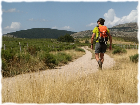
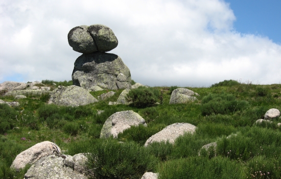
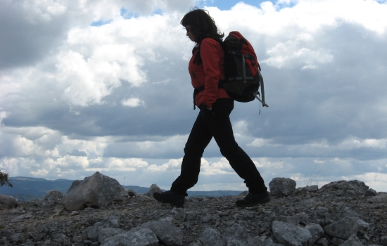
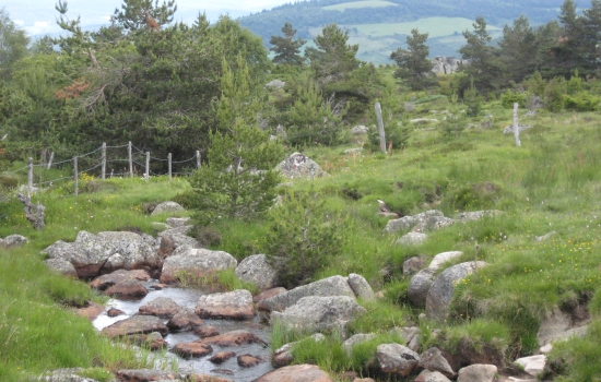
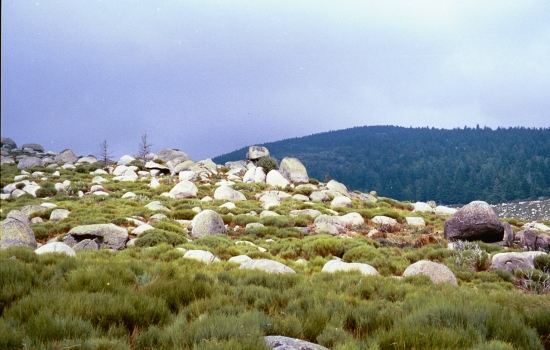
Mounts Lozere is a massif with round mountains covered with a special moor scattered with granitic rocks. Before reaching this area, you hike in the forests above the Tarn river, you admire the traditional architecture of the hamlets and the people living here will leave you souvenirs.
Tarn river springs inside a peat bog area and then snakes in the pastures. When walking down to the valley, you meet the chestnut trees, sumbol of the Cevennes.
This protected nature, the scenery and the authentic villages will charm you.
Formules proposées
Guided tour
From 4 persons, your can be guided by a fully qualified local guide. This person is passionate by his region and he knows how to share with you his knowledge about landscapes, the flora and the fauna or the heritage
Self guided tour
You are given maps (1cm=250m) and a road book describing the hike.
Les temps forts du voyage
- the gradual climb up the massif
- the ascent of Finiels (1,699 m), the highest peak in the Cévennes, and the 360° panorama
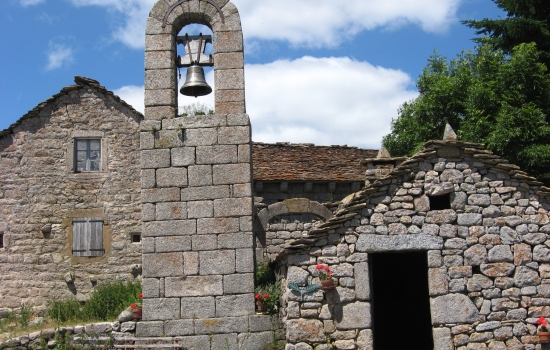
- the storm bell towers
- the hamlets of Mt Lozère
- the built heritage (typical rural architecture)
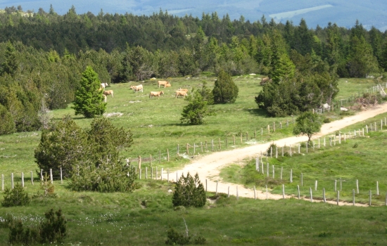
- moors, summit grasslands and granite chaos
- pastoralism (Causses & Cévennes area - UNESCO classification)

L'avis des voyageurs
Cher Frédéric,
Veuillez nous excuser pour notre réponse tardive ; nous avons eu un emploi du temps très chargé depuis notre retour…
Nous tenions toutefois à vous remercier pour les merveilleuses vacances que vous nous avez organisées ! Tout était parfait : l’itinéraire, les paysages magnifiques, l’hébergement et l’accueil chaleureux à chaque étape, la cuisine de grande qualité et les portions très copieuses.
Nous avons été ravis de la qualité du service, nous avons passé une semaine inoubliable et nous n’hésiterons pas à faire de nouveau appel à vous pour nos prochaines vacances.
Nous avons d’ailleurs parlé de vous à nos amis et à notre famille :-)
Merci pour tout !
Véronique et Sandra
Bonsoir,
Encore sous le charme des paysages sauvages que nous avons découverts lors de cette randonnée autour du Mont Lozère, nous tenons à vous dire à quel point ces paysages ont apaisé nos âmes, que ce soit à un virage du sentier, en nous approchant d’une fleur, à l’ombre d’un châtaignier, face au granit ou au calcaire, à la vue des toits d’ardoise, en nous baignant dans une mer de genêts ou en entendant le chant du coucou.
Que dire de plus, si ce n’est que la fatigue accumulée au fil des journées n’a jamais entamé notre détermination à mener ce circuit à bien, même face aux vents, aux pluies et aux inévitables hauts et bas qui ont pimenté notre randonnée.
Les étapes étaient bien calibrées et les lieux traversés intéressants.
L’hébergement était globalement satisfaisant.
Les repas et les pique-niques étaient de bonne qualité.
Dans la brochure : veuillez indiquer un bagage par personne, muni d'une étiquette portant le nom de la personne, son numéro de portable et le nom de l'organisation qui l'a parrainée.
Merci beaucoup et peut-être nous reverrons-nous sur un nouveau chemin.
Cordialement,
Alain.
NIVEAU
This hike is quite easy, although you need to be in a good shape. A regular physical effort all year long will help you to have fun during this trip.
Le PROGRAMME
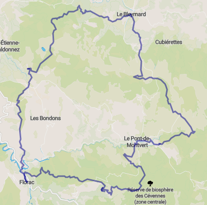
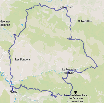
This 4, 5 or 6 days hike takes you throughout the Mounts Lozere mountains and its highest point the Finiels Peak (1699 meters high). Everyday the environment changes.
4 days tour
Day 1 : 22,5 km - elevation : +985 m
Day 2 : 19.5 km - elevation : +640 m
Day 3 : 19 km - elevation : +705 m
Day 4 : 23 ou 14.5 km - elevation : +465 or 120 m
5 days tour
Day 1 : 15 km - elevation : + 840 m
Day 2 : 21 km - elevation : + 675 m
Day 3 : 20 km - elevation : + 640 m
Day 4 : 21.5 km - elevation : + 735 m
Day 5 : 19 km - elevation : + 565 m
6 days tour
Day 1 : 19 km - elevation : + 670 m
Day 2 : 21.5 km - elevation : + 960 m
Day 3 : 20 km - elevation : +705 m
Day 4 : 25 km - elevation : +505 m
Day 5 : 21 km - elevation : + 825 m
Day 6 : 16 km - elevation : + 195 m
PERIODS
From April to November
Slideshow
Slide 1 selected
| La prestation comprend |
|
• Accommodation in gite for groups, hotels or in B&B. • Breakfasts, packed lunches and dinners. • The road book and the maps in the self guided trip or a guide in the guided tour. |
| La prestation ne comprend pas |
|
• Personal expenditure • Comprehensive insurance (4,5%) |
VENIR EN TRAIN
We all know the impact of our car travels on the environment. Driving to the holidays location can produce a large amount of CO2 because of the long haul distance to get away...
Therefore, if low impact mobility interests you, Villefort or Mende, welcomes you. A bus or our minivan can take you to your accommodation.
Check your journey by train with SNCF or OUIGO and contact us for any further information.
Mounts Lozere is a massif with round mountains covered with a special moor scattered with granitic rocks. Before reaching this area, you hike in the forests above the Tarn river, you admire the traditional architecture of the hamlets and the people living here will leave you souvenirs.
Tarn river springs inside a peat bog area and then snakes in the pastures. When walking down to the valley, you meet the chestnut trees, sumbol of the Cevennes.
This protected nature, the scenery and the authentic villages will charm you.
Program
This 4, 5 or 6 days hike takes you throughout the Mounts Lozere mountains and its highest point the Finiels Peak (1699 meters high). Everyday the environment changes.
4 days tour
Day 1 : 22,5 km - elevation : +985 m
Day 2 : 19.5 km - elevation : +640 m
Day 3 : 19 km - elevation : +705 m
Day 4 : 23 ou 14.5 km - elevation : +465 or 120 m
5 days tour
Day 1 : 15 km - elevation : + 840 m
Day 2 : 21 km - elevation : + 675 m
Day 3 : 20 km - elevation : + 640 m
Day 4 : 21.5 km - elevation : + 735 m
Day 5 : 19 km - elevation : + 565 m
6 days tour
Day 1 : 19 km - elevation : + 670 m
Day 2 : 21.5 km - elevation : + 960 m
Day 3 : 20 km - elevation : +705 m
Day 4 : 25 km - elevation : +505 m
Day 5 : 21 km - elevation : + 825 m
Day 6 : 16 km - elevation : + 195 m
PERIODS
From April to October

Séjour marqué "Esprit Parc National des Cévennes"
A travers cet agrément, Languedoc Nature est récompensé pour son engagement en matière de préservation des patrimoines naturels et culturels du territoire du Parc National des Cévennes, dans une démarche de tourisme durable..
Trip highlights
- the gradual climb up the massif
- the ascent of Finiels (1,699 m), the highest peak in the Cévennes, and the 360° panorama
- the storm bell towers
- the hamlets of Mt Lozère
- the built heritage (typical rural architecture)
- moors, summit grasslands and granite chaos
- pastoralism (Causses & Cévennes area - UNESCO classification)
Guided tour
From 4 persons, your can be guided by a fully qualified local guide. This person is passionate by his region and he knows how to share with you his knowledge about landscapes, the flora and the fauna or the heritage
Self guided tour
You are given maps (1cm=250m) and a road book describing the hike.
Niveau
This hike is quite easy, although you need to be in a good shape. A regular physical effort all year long will help you to have fun during this trip.
Travel advisories
Cher Frédéric,
Veuillez nous excuser pour notre réponse tardive ; nous avons eu un emploi du temps très chargé depuis notre retour…
Nous tenions toutefois à vous remercier pour les merveilleuses vacances que vous nous avez organisées ! Tout était parfait : l’itinéraire, les paysages magnifiques, l’hébergement et l’accueil chaleureux à chaque étape, la cuisine de grande qualité et les portions très copieuses.
Nous avons été ravis de la qualité du service, nous avons passé une semaine inoubliable et nous n’hésiterons pas à faire de nouveau appel à vous pour nos prochaines vacances.
Nous avons d’ailleurs parlé de vous à nos amis et à notre famille :-)
Merci pour tout !
Véronique et Sandra
Bonsoir,
Encore sous le charme des paysages sauvages que nous avons découverts lors de cette randonnée autour du Mont Lozère, nous tenons à vous dire à quel point ces paysages ont apaisé nos âmes, que ce soit à un virage du sentier, en nous approchant d’une fleur, à l’ombre d’un châtaignier, face au granit ou au calcaire, à la vue des toits d’ardoise, en nous baignant dans une mer de genêts ou en entendant le chant du coucou.
Que dire de plus, si ce n’est que la fatigue accumulée au fil des journées n’a jamais entamé notre détermination à mener ce circuit à bien, même face aux vents, aux pluies et aux inévitables hauts et bas qui ont pimenté notre randonnée.
Les étapes étaient bien calibrées et les lieux traversés intéressants.
L’hébergement était globalement satisfaisant.
Les repas et les pique-niques étaient de bonne qualité.
Dans la brochure : veuillez indiquer un bagage par personne, muni d'une étiquette portant le nom de la personne, son numéro de portable et le nom de l'organisation qui l'a parrainée.
Merci beaucoup et peut-être nous reverrons-nous sur un nouveau chemin.
Cordialement,
Alain.
Slideshow
Slide 1 selected
| La prestation comprend |
|
• Accommodation in gite for groups, hotels or in B&B. • Breakfasts, packed lunches and dinners. • The road book and the maps in the self guided trip or a guide in the guided tour. |
| La prestation ne comprend pas |
|
• Personal expenditure • Comprehensive insurance (4,5%) |
COME BY TRAIN
We all know the impact of our car travels on the environment. Driving to the holidays location can produce a large amount of CO2 because of the long haul distance to get away...
Therefore, if low impact mobility interests you, Villefort or Mende, welcomes you. A bus or our minivan can take you to your accommodation.
Check your journey by train with SNCF or OUIGO and contact us for any further information.
Guided tour
From 4 persons, your can be guided by a fully qualified local guide. This person is passionate by his region and he knows how to share with you his knowledge about landscapes, the flora and the fauna or the heritage
Self guided tour
You are given maps (1cm=250m) and a road book describing the hike.
Niveau
This hike is quite easy, although you need to be in a good shape. A regular physical effort all year long will help you to have fun during this trip.